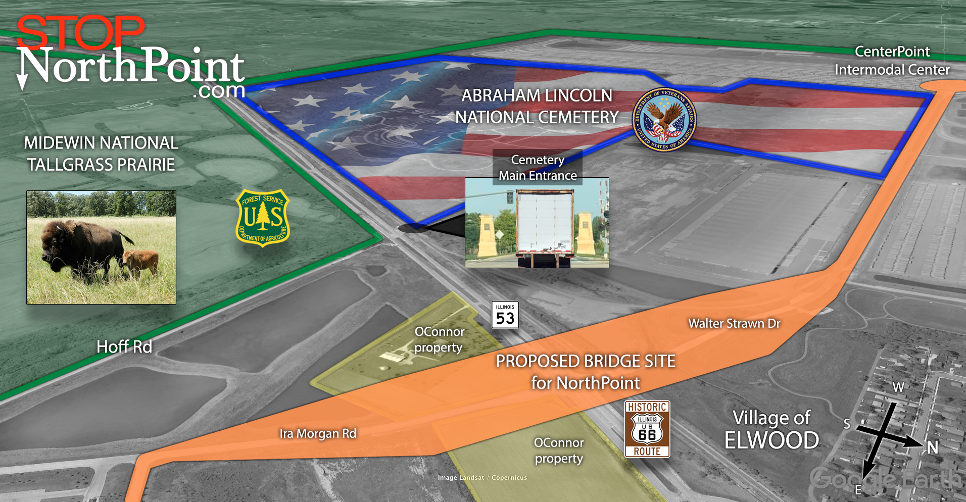
NorthPoint’s bridge harms national veterans cemetery
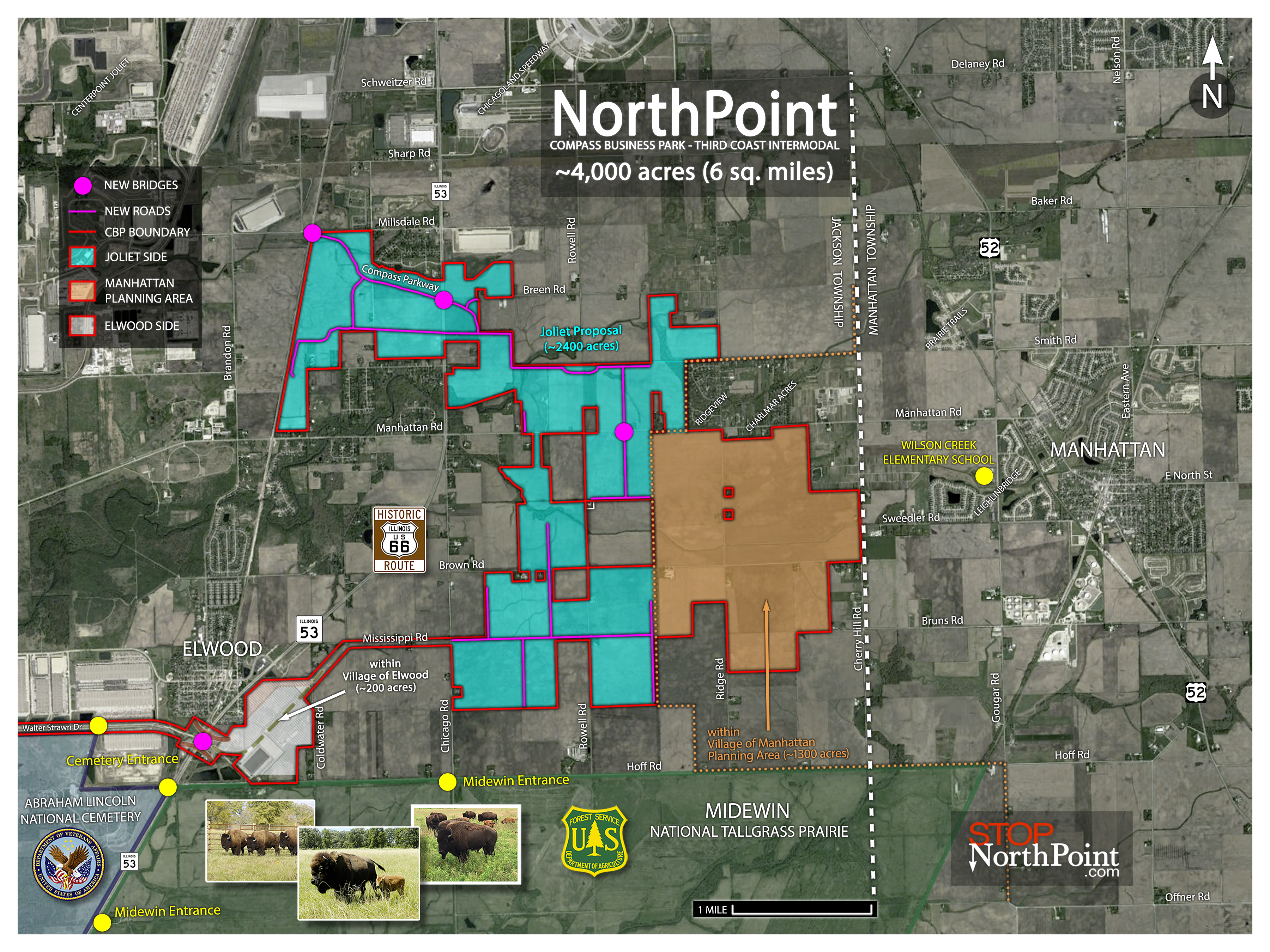
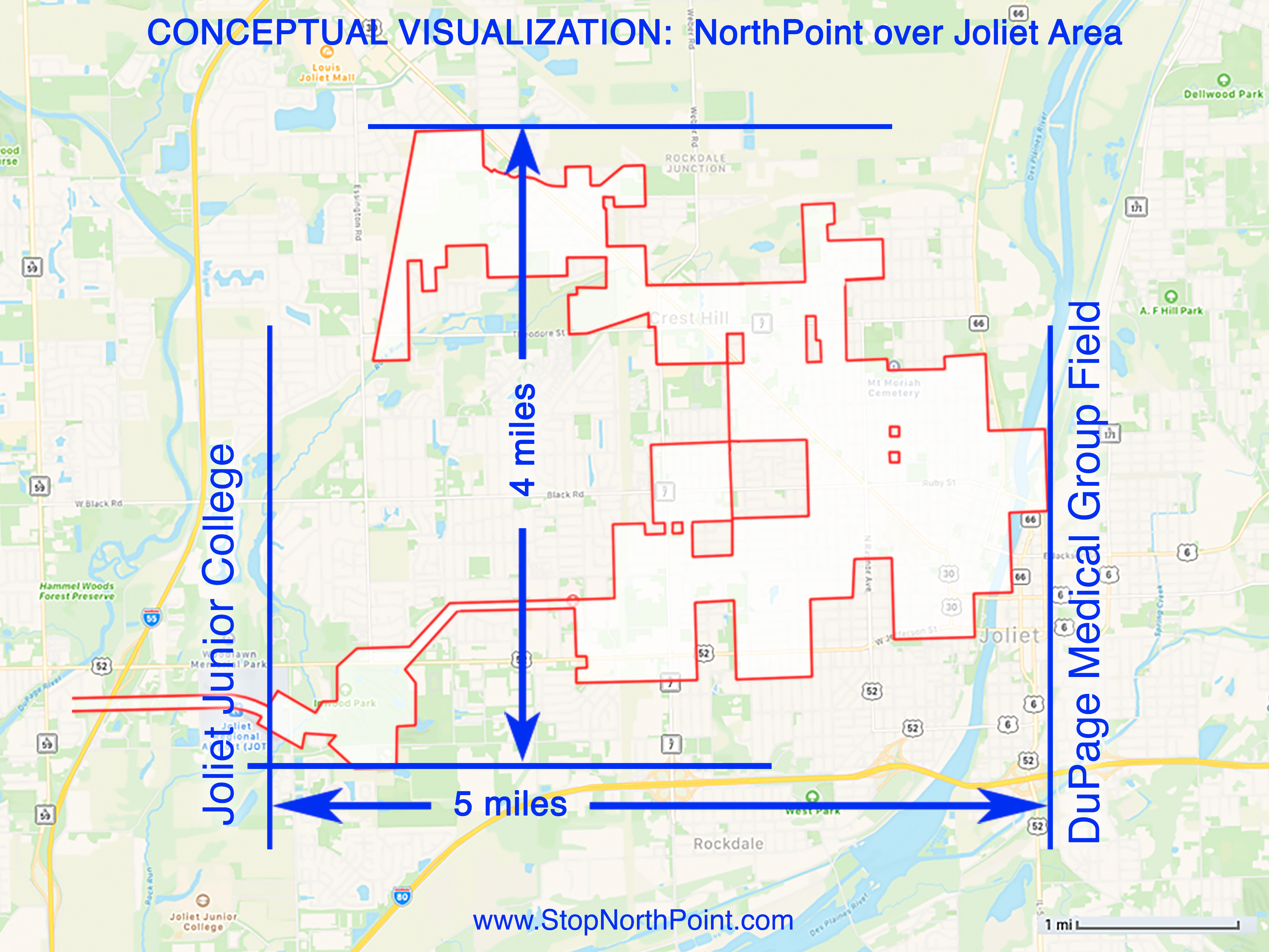
Compass over Joliet
This “conceptual” overlay map shows the same footprint of the proposed Compass Business Park on top of the City of Joliet. The sole purpose is to illustrate the massive size and scale of the project. It would stretch from Joliet Junior College to Slammers Stadium and from Louis Joliet Mall to Rockdale.
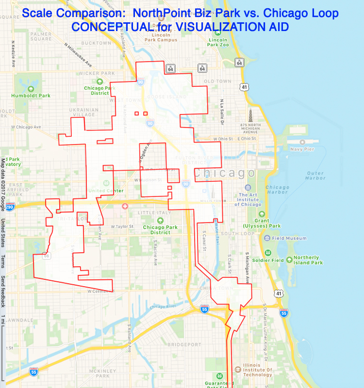
Compass over Chicago Loop
This “conceptual” overlay map shows the same footprint of the proposed Compass Business Park on top of the City of Chicago. The sole purpose of this drawing is to illustrate the massive size and scale of the project. It would stretch from Lincoln Park to Sox Park and from Kedzie Ave to Soldier Field.